Diseñando Hogares Hermosos para El Valle del Río Grande
Creemos que cada familia trabajadora merece un hogar al que sea un placer regresar, con un diseño que amen, que funcione bien para sus necesidades diarias y que esté bellamente hecho para reflejar su estilo único.
Lo que obtendrás con Sky Point:
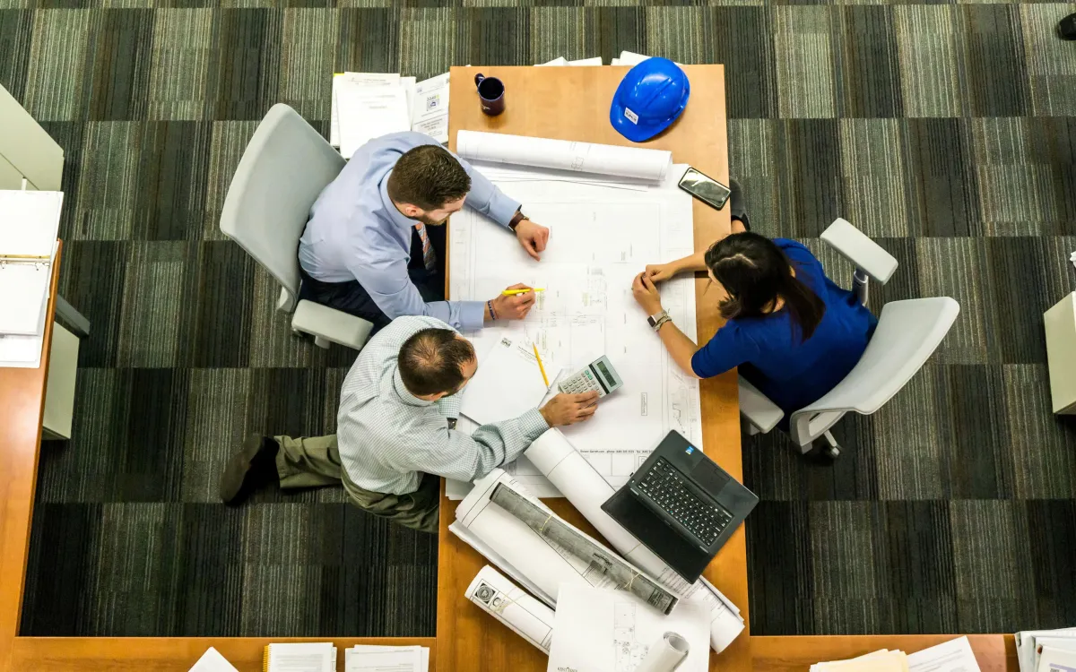
Consulta y Desarrollo del Concepto
En esta primera etapa escuchamos tus necesidades, estilo de vida y visión para tu casa. Revisamos cualquier idea, boceto o inspiración que ya tengas y transformamos todo ese material en un concepto inicial que se ajuste a tu terreno, tus preferencias y tu presupuesto.
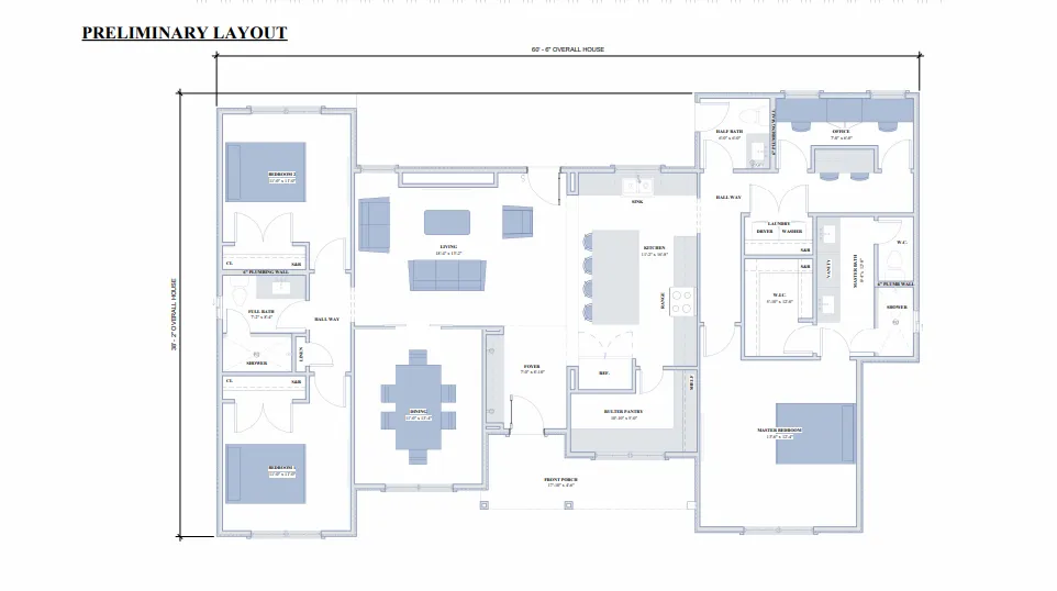
Planos Preliminares
Diseñamos los primeros planos de planta y elevaciones. Definimos la distribución y el estilo general, y ajustamos el diseño para que visualices tu futuro hogar.
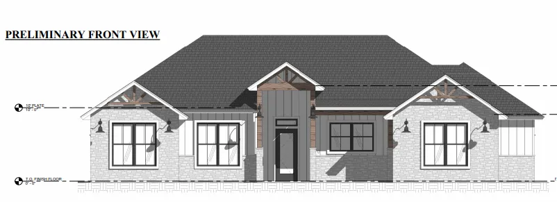
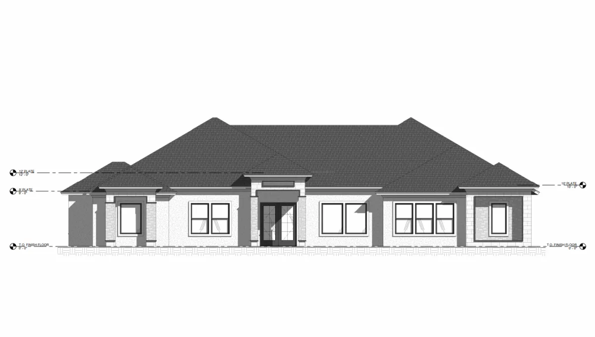
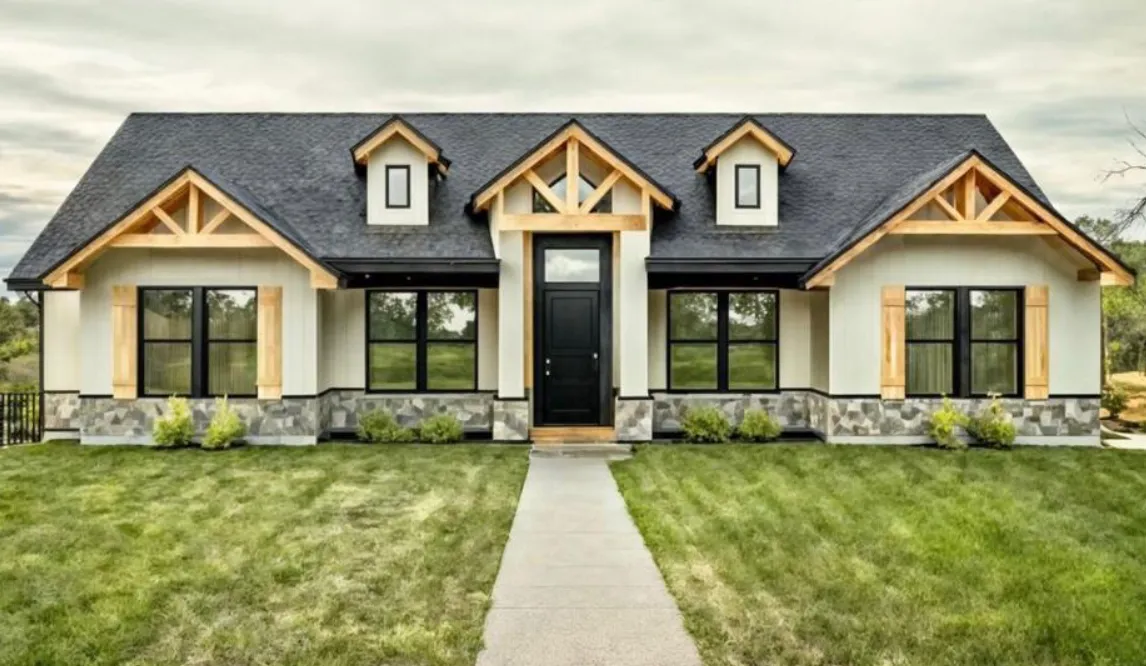
Elevations
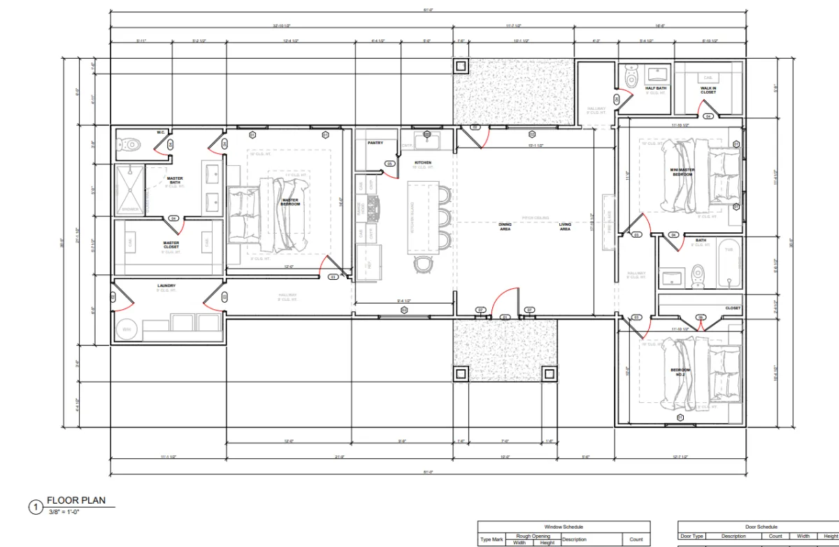
Elaboramos planos precisos y a escala con todas las dimensiones. Incluimos muros, puertas, ventanas y verificamos que cumplan con los códigos locales de construcción.
Planos Finales
Entregamos un juego completo de planos listos para tu constructor. Incluyen plantas, elevaciones, secciones y detalles técnicos para que la obra se ejecute sin dudas.
Lo que obtendrás con Sky Point:
Drafting
En esta primera etapa escuchamos tus necesidades, estilo de vida y visión para tu casa. Revisamos cualquier idea, boceto o inspiración que ya tengas y transformamos todo ese material en un concepto inicial que se ajuste a tu terreno, tus preferencias y tu presupuesto.
Planos Preliminares
Diseñamos los primeros planos de planta y elevaciones. Definimos la distribución y el estilo general, y ajustamos el diseño para que visualices tu futuro hogar.
Elevations
Elaboramos planos precisos y a escala con todas las dimensiones. Incluimos muros, puertas, ventanas y verificamos que cumplan con los códigos locales de construcción.
Planos Finales
Entregamos un juego completo de planos listos para tu constructor. Incluyen plantas, elevaciones, secciones y detalles técnicos para que la obra se ejecute sin dudas.
Galeria

Testimonials
Working with them was a great experience. They made our vision come to life, and now we have a space we love and feel proud of
– Maria G., McAllen, TX
They understood exactly what we needed and created a design that fits our family perfectly. The process was smooth and stress-free!
– Chris R., Harlingen, TX
El diseño que hicieron para nosotros superó nuestras expectativas. Cada detalle fue pensado, y ahora tenemos el lugar perfecto para nuestra familia.
– Juan S., Brownsville, TX
FAQS
Pueden ayudarme a diseñar una casa que se ajuste a mi presupuesto?
¡Por supuesto! Trabajamos de cerca contigo para diseñar una casa que se alinee con tu visión y se mantenga dentro de tu presupuesto. Nuestro objetivo es crear un espacio que logre el equilibrio perfecto entre belleza, funcionalidad y accesibilidad.
¿Qué tan involucrado puedo estar en el proceso de diseño?
¡Todo lo que quieras! Valoramos tu opinión en cada etapa. Desde los bocetos iniciales hasta los planos finales, nos aseguramos de que formes parte del proceso para que el diseño de tu casa refleje tus preferencias y estilo de vida.
¿En qué tipos de diseños de casas se especializan?
Nos especializamos en diseños de casas personalizados que reflejan tu estilo personal y se adaptan a las necesidades de tu familia. Ya sea que busques un diseño moderno, tradicional o único, creamos soluciones a la medida para cada hogar.
¡Ponte en contacto y comienza hoy tu proyecto soñado!
956 997-8685
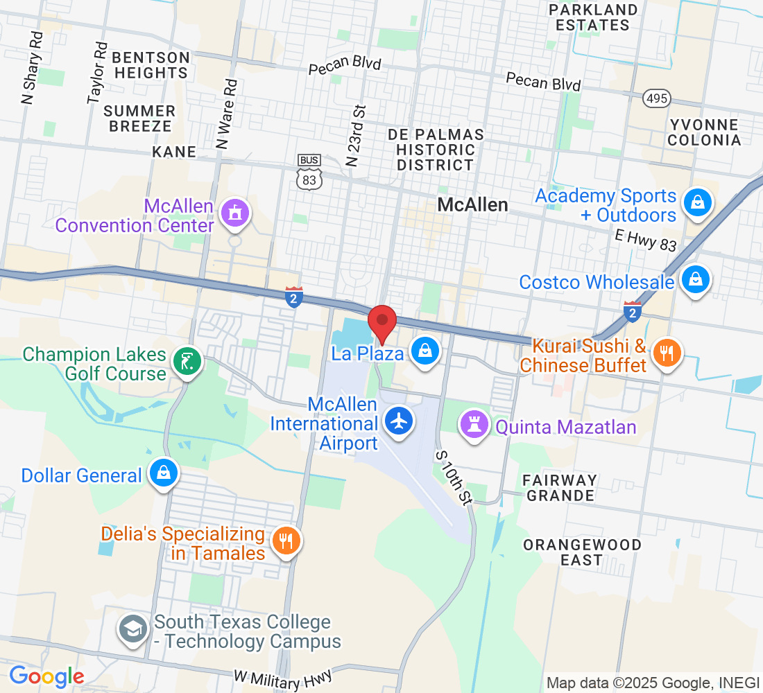
1711 Savanah ave, McAllen TX